| Sunday |
Monday |
Tuesday |
Wednesday |
Thursday |
Friday |
Saturday |
26
|
27
4-27-26 9:00 am | Hike
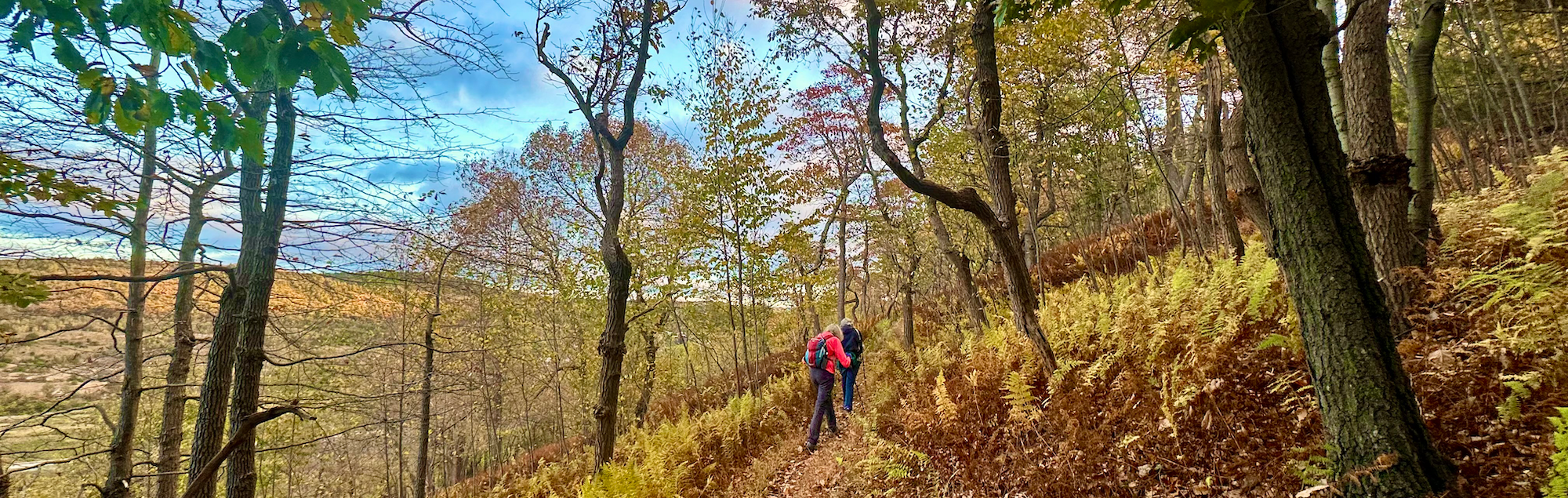
Neversink Mountain HikeSpring loop hike on the trails of Neversink Mountain Preserve
This hike will cover around 7 miles and 1000' of elevation gain. Neversink Mountain Preserve is a 900 acre preserve in Reading with trails along the abandoned rail tracks. There are several scenic overlooks and diverse flora and fauna. Be prepared for muddy conditions in spots. Bring adequate hydration and trail snacks, insect repellant and sunscreen. Dress for the weather and wear footwear with good grip. Rain will cancel this event. Details
Hike / bike / on-water distance: 6-7 miles
Hike rating: C+
Meeting place: There are several access points for the preserve. For this hike we will meet at the parking lot at the end of Klapperthal Road (off of Neversink Road). The address is 91 Klapperthal Rd, Reading, PA 19606
Posted on meetup.com? NO
Leader: Heidi Forgione 703-402-1057
|
28
|
29
|
30
|
1
5-1-26 4:45 pm | Hike
Hike to the Pulpit and Pinnacle under the Full Flower Moon (9 miles)Watch the full moon rise from the Pinnacle
Please arrive by 4:45pm for a prompt 5:00pm departure. As we will need to make it up to the Pinnacle by sunset, the group will leave on time. Please plan accordingly.
Come and watch the full moon rise from the Pinnacle! May's Full Moon, the Flower Moon, is named because it coincides with the time of year when flowers, shrubs, and trees bloom in abundance across the Northern Hemisphere, signaling the peak of Spring.
This is a 9 mile loop hike, starting at the Hamburg Reservoir parking lot and then going up to the Pulpit and Pinnacle for spectacular views of the rising full moon. Sunset is at 7:59pm and moonrise is at 8:24pm.
This is not a beginner's hike due to the ~1200' ascent, rocky terrain and nighttime conditions. Sturdy hiking boots are recommended. Bring a headlamp or flashlight, at least 2 liters of water and food/snacks. Also bring extra layers for when we are sitting at the Pinnacle waiting for the full moon to rise. Rain or cloudy conditions may cancel. Details
Hike / bike / on-water distance: 9 miles
Hike rating: C
Meeting place: Hamburg Reservoir parking lot, 420 Reservoir Road Hamburg, PA
Posted on meetup.com? NO
Leader: Paula Uhrin 484-951-4299
Hike to the Pulpit and Pinnacle under the Full Flower Moon (9 miles)
|
2
5-2-26 9:00 am | Hike
Eckville Shelter History Hike4 miles of rewarding and scenic ridge walking.
This historical 4 hike to the Eckville Appalachian Trail Shelter begins at Pine Swamp Road and follows a time-honored blue-blazed route steeped in Appalachian Trail history. The climb winds steadily through mature forest and rocky outcrops before connecting with the Appalachian Trail itself, where generations of hikers have passed through this corridor of Pennsylvania’s Blue Mountain. The destination, the Eckville Appalachian Trail Shelter, is one of the oldest shelters on the AT and uniquely includes a caretaker’s residence—making it a living link to the early stewardship of the Trail. This hike offers not only a rewarding ascent and scenic ridge walking, but also a meaningful opportunity to experience a landmark that reflects the enduring spirit, community, and volunteer legacy of the Appalachian Trail.
Please bring snacks, fluids and an interest in learning about the history of the Appalachian Trail and the Eckville area and Shelter in Berks County. Details
Hike / bike / on-water distance: 4 miles
Hike rating: A+
Meeting place: Eckville trail parking at 409 Pine Swamp Rd, Kempton, PA 19529
Posted on meetup.com? YES
Leader: Howard Reid 610-420-8194
Eckville Shelter History Hike
|
3
|
4
|
5
|
6
5-6-26 7:00 pm | Meeting
MAY MONTHLY MEETINGMonthly Business Meeting and presentation by Steve Carpenter, author of Allure and Peril of the Appalachian Trail.
Details
Meeting place: St. Timothy's Lutheran Church, 140 South Ott Street, Allentown, PA Enter from the back parking lot
Posted on meetup.com? NO
Leader: Paula Uhrin 484-951-4299
Co-leader: Karen Gradel 267-424-4602
|
7
|
8
|
9
|
10
|
11
5-11-26 8:00 am | Hike
Trexler Border Trailspring loop hike around Trexler Nature Preserve
This is a 9 mile loop with significant elevation gain - about 1500' worth - as we traverse up and over the ranges around the preserve. Several inclines are steep. Most of the trail is packed dirt with some gravelly areas and some loose rocky spots. Bring plenty of water/fluids and trail snacks. Wear comfortable shoes with good traction. Trekking poles or a walking stick can be helpful on the steeper areas. We will aim to keep a steady pace with a few short breaks along the way to take in the views in various areas. Details
Hike / bike / on-water distance: 9 miles
Hike rating: C
Meeting place: 4935 Orchard Rd, Schnecksville (Orefield)
Posted on meetup.com? NO
Leader: Heidi Forgione 703-402-1057
|
12
5-12-26 9:00 am | Maintenance
AT Section/Maintenance Hike (7-8 miles)Out and back AT hike from Fort Franklin Road to Tri County Corner
I'll be hiking my section of the AT on Tuesday, 12 May and anyone interested in a 7-8 mile out and back hike on rocky terrain is welcome to come along.
There could be some trail maintenance along the way, so bringing a pair of work gloves could be a good idea, along with any loppers, clippers, or hand saws you might have. We'll stop at the Allentown Shelter on either the out or back (or both, if needed) for a break/lunch. Details
Hike / bike / on-water distance: 7-8 miles
Meeting place: Meet at 9 am at the parking lot where Fort Franklin Road crosses the Appalachian Trail.
Posted on meetup.com? NO
Leader: Paula Uhrin 484-951-4299
AT Section/Maintenance Hike (7-8 miles)
|
13
|
14
5-14-26 9:30 am | Hike
Midweek Ricketts Glen Day Hike (7-8 miles)Loop hike around the 21 Waterfalls of Ricketts Glen State Park
I'm hoping to miss the crowds and hike this on a Thursday. We will meet at the parking lot on Route 118 and hike the lollipop loop north and then clockwise to view all 21 waterfalls of Ricketts Glen. Trail conditions are likely to be muddy and slick and therefore sturdy hiking boots are required, and trekking poles are suggested. We will be taking our time to enjoy the waterfalls and the views and I'm expecting this to take a full day. Bring at least 2L of water plus lunch/snacks. Heavy rains or thunderstorms will cancel. Details
Hike / bike / on-water distance: 7-8 miles
Hike rating: C
Meeting place: Glens Lot Trailhead Parking on Route 118 (41.300190, -76.272543)
Posted on meetup.com? NO
Leader: Paula Uhrin 484-951-4299
Midweek Ricketts Glen Day Hike (7-8 miles)
|
15
|
16
5-16-26 9:00 am | Maintenance
Annual Maintenance Hike & PicnicAnnual Club Maintenance Hike in the am, Picnic in the pm
Wear hiking boots, bring work gloves, water, and snacks. You can also bring small hand saws or clippers if you have them; otherwise, tools will be provided. From removing trash to trimming back encroaching vegetation, to painting blazes, to removing blowdowns, to clearing invasives, to checking on the shelter, there will be something for everyone to do. RAIN DATE: May 17th
Then, meet by 1pm for picnic at Leaser Lake - North Ramp.
Bring a dish to share. Hot dogs provided.
Details
Round trip road miles distance: 0-6 miles
Hike / bike / on-water distance: <=6 miles
Hike rating: A
Meeting place: TBD: Either Fort Franklin Road trailhead or Route 309 trailhead across from Thunderhead Lodge.
Posted on meetup.com? NO
Leader: Kerry Snyder 610-737-7768
Annual Maintenance Hike & Picnic
|
17
|
18
|
19
|
20
5-20-26 7:00 am | Hike
Early Morning Leaser Lake Loop Hike (4 or 8 miles)An early morning hike
This is a relatively flat loop trail around Leaser Lake in Kempton. There are some rocky sections and a creek crossing or two, but most of this hike is on gentle terrain. After one 4 mile loop, those who want a longer hike will repeat the loop in the opposite direction. Steady rain will cancel. Bring water and lunch/snacks. Details
Hike / bike / on-water distance: 4 or 8 miles
Hike rating: B+
Meeting place: Leaser Lake South Boat Ramp parking lot
8498 Pleasure Court, Kempton
Posted on meetup.com? NO
Leader: Paula Uhrin 484-951-4299
Early Morning Leaser Lake Loop Hike (4 or 8 miles)
|
21
|
22
|
23
|
24
|
25
5-25-26 6:30 am | Hike
CANCELED DUE TO RAIN!! Breakfast at Bear Rocks Memorial Day hikeEarly bird hike on Memorial Day across Knife's Edge to Bear Rocks
Get an early start, beat the heat and get home in time for your cookout! We will start at the Rt. 309 Appalachian Trail parking area and head north on the AT, across the infamous Knife Edge to Bear Rocks - a big rock scramble with an amazing almost 360 view. Bring a trail breakfast and we'll enjoy it here.
Afterward we will return to the 309 parking area, possibly by taking the bypass trail on the return trip.
This is a rocky section of the AT with an overall elevation gain of around 700'. Crossing the Knife's Edge involves shimmying sideways across a narrow rock ledge. To get the view at Bear Rocks you will have to climb up a large pile of large boulders. Please take this information into consideration when deciding if this is a hike for you or not.
Wear shoes with good grip that work for you on rocky terrain. Bring adequate hydration and a trail breakfast, sunscreen and bug spray recommended as well. Details
Hike / bike / on-water distance: 7 miles
Hike rating: C
Meeting place: Meet at Rt 309 Appalachian Trail parking lot
Posted on meetup.com? NO
Leader: Heidi Forgione 703-402-1057
CANCELED DUE TO RAIN!! Breakfast at Bear Rocks Memorial Day hike
|
26
|
27
5-27-26 8:00 am | Hike
Birding hike and paddle at Leaser LakeLoop hike around Leaser Lake with birdwatching stops, followed by a paddle
Meet at Pleasure Court (south) boat ramp at 8 am for a 5 mile loop hike around Leaser Lake. We will keep a steady pace while moving, but make four or so stops in the different habitats around the lake to identify birds. We'll also take an (optional) trip up the gravel road north of the lake to get a little elevation in. There is not much elevation change on the lake trail but there will likely be some wet/muddy areas. Bring binoculars if you have them. I am still a relatively beginner birder but all experience levels are welcome.
After our hike, around 10-10:30 am, those interested can get on the water on a paddle board/kayak/canoe for a paddle around the lake. You must have your own watercraft with a valid PA state license/permit and a life vest.
Bring water, a snack, sunscreen, insect repellant. Details
Hike / bike / on-water distance: 5 miles
Hike rating: B+
Meeting place: 8498 Pleasure Ct, Kempton, PA 19529 (Leaser Lake South Ramp) -Google Map link: https://www.google.com/maps/place/Leaser+Lake+South+Ramp/@40.6709748,-75.8335446,552m/data=!3m2!1e3!4b1!4m6!3m5!1s0x89c5c913a2711815:0xaa9eca35abc222fa!8m2!3d40.6709748!4d-75.8335446!16s%2Fg%2F11d_1lw8fq?entry=ttu&g_ep=EgoyMDI2MDUyMC4wIKXMDSoASAFQAw%3D%3D
Posted on meetup.com? NO
Leader: Heidi Forgione 703-402-1057
Birding hike and paddle at Leaser Lake
|
28
|
29
|
30
|
31
5-31-26 5:30 pm | Hike
Jim Gabovitz 4th Annual Memorial Whip-Poor-Will Hike under the Full Blue Moon (5-6 miles)Point to point hike starting from the Osprey House and finishing at Translater Lane.
This is an evening trek where will hike a series of trails throughout Lehigh Gap Nature Center property... LNE Trail, Prairie Grass Trail, Charcoal Trail, Appalachian Trail up to a grouping of cell towers where we will wait for sunset before descending Translater Lane. Total elevation gain will be approximately 1,200'. At the towers we will wait for dark and listen for the calls of the Whip-Poor-Will on our way back down. We will be hiking in the dark on the descent so a flashlight or headlamp is essential. Please bring snacks, water, and wear sturdy hiking boots. Trekking poles are recommended as the area we will be hiking is steep and rocky. Steady rain cancels. Details
Hike / bike / on-water distance: 5-6 miles
Hike rating: B+
Meeting place: Osprey House at Lehigh Gap Nature Center (LGNC), https://lgnc.org
Posted on meetup.com? NO
Leader: Paula Uhrin 484-951-4299
Jim Gabovitz 4th Annual Memorial Whip-Poor-Will Hike under the Full Blue Moon (5-6 miles)
|
1
|
2
6-2-26 10:00 am | Hike
Appalachian Trail :Wind Gap to Smith Gap (Point to Point)Stunning views, rugged terrain
Description: Wind Gap to Smith Gap offers stunning views of Pennsylvania’s rugged terrain, featuring dense forests, rocky ridges, and scenic overlooks. Hikers can enjoy the diverse flora and fauna along the way while exploring a portion of one of America's iconic long-distance trails. It's a great opportunity to experience the natural beauty of the Appalachian Mountains.
Expect rocky footing in places and come prepared with sturdy footwear, snacks, lunch, and plenty of fluids; the hike will be canceled in the event of adverse weather. Details
Hike / bike / on-water distance: 7.9 miles
Hike rating: C+
Meeting place: PA-115, Wind Gap, PA 18091, Coordinates: 40.86058° N, 75.29267° W
Posted on meetup.com? YES
Leader: Howard Reid 610-420-8194
Appalachian Trail :Wind Gap to Smith Gap (Point to Point)
|
3
6-3-26 7:00 pm | Meeting
JUNE MONTHLY MEETINGMonthly Business Meeting and presentation by Alexis McAllister, Trails Chair with the Blue Mountain Eagle Climbing Club, will talk about Orienteering including some hands on activities.
Details
Meeting place: St. Timothy's Lutheran Church, 140 South Ott Street, Allentown, PA Enter from the back parking lot
Posted on meetup.com? NO
Leader: Paula Uhrin 484-951-4299
Co-leader: Karen Gradel 267-424-4602
|
4
|
5
|
6
|